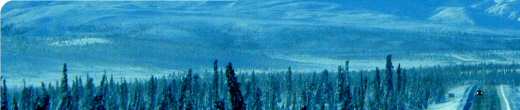
Well, after a wet second half of Maine, we drove down to Littleton, Massachusetts only to find more rain. Its turns out that all of New England is getting soaked and dealing with flooding. The odd thing is to us Floridians, is that it isn't really "raining" like we know it to cause flooding. It's not a heavy rain, just a constant rain where the sun never comes out to dry things up. However, we'll just have to make the best of things.
We arrived at the Minutemen Campgrounds after dark and just before the manager left. It was a good thing too, because I would have had a difficult time backing in to our spot without him guiding me in. It was so dark and the campground had a lot of trees.
The next morning we quickly ate breakfast and started with school so that we could leave for Boston. By the time school was over, it was close to 11:00am and Boston was still an hours drive away. We all hopped in the Blazer and headed out. As we got closer to the city, traffic got heavier and slower. Then we started seeing the signs for the "T", Boston's subway system. After a short discussion, we felt that using the subway system would be the best way to go. It would be quicker getting into Boston and we wouldn't have to worry about finding a parking space. So we quickly pulled off the highway, parked at the station, and hopped onboard the subway. This was the first time any of us had ever rode on a subway before so it became an adventure by itself.
Once onboard, we met a local Bostonian who over heard our conversation about where we should get off to be near the historic sites. He quickly gave us a rundown of the subway routes and the best stops for tourists. That was a big help. We exited the subway right at Boston Commons, right in front of the current capital building. This was also the near the beginning of the "Freedom Trail", which was a marked path around Boston to view the historic buildings. We quickly found a visitor information booth to pick up a brochure on the Freedom Trail so we could better follow the path and read about the different buildings.
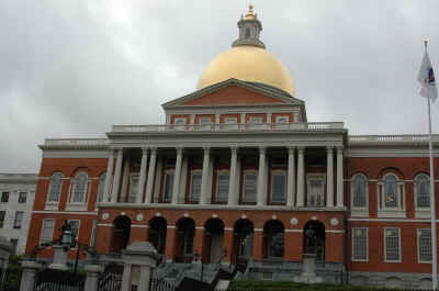
By this time however, it was well past noon and all we could think about was food! I quickly snapped some photos of the capital building and off we went. Our first goal was to find a place to eat.
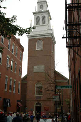
After lunch we continued down the Freedom Trail. Some of the buildings we saw were Paul Revere's House, the old State House building, Faneuil Hall, the first public school site, and the Old North Church. One of the problems we had, was getting a late start. We had only walked halfway along the trail and it was already 4pm. And we still had to walk back! Once we got to the bridge to cross over to view the U.S.S. Constitution and Bunker Hill, we had to turn back. We did not have time to see the rest of the historical sites. Tomorrow the plan was to return and visit the Boston Museum of Science. If we had time left after that, we would finish the Freedom Trail.
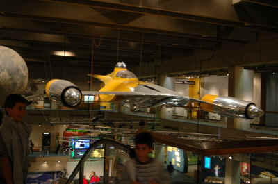
The next day we decided to get an earlier start. The plan was to leave for Boston early and then complete school upon returning to the RV. After exiting the subway, it was a short walk to the museum. Upon arriving at the Boston Museum of Science, we quickly headed to the planetarium where the show "Super Nova" was getting ready to start. After that, we walked across the hall to the Imax theater to see the Antarctica movie. The rest of the day was spent looking at the remaining 3 floors of exhibits. I think the boys favorite display was the life-sized space craft from the Star Wars movie. There was a lot to see. By the time we finished the museum, there wasn't time to finish the Freedom Trail. So back to the subway and getting home.
Today, we drive west down the Mohawk Trail to my brother-in-law's house in North Adams, Massachusetts.
Until next time....
Mark